Snowdonia...it's a real place.
Today we headed to the national park that surrounds the 2nd highest mountain in Britain, Mount Snowdon, which just had to be climbed.
We did some research thanks to a website called "Walking Englishman" to find a trail that worked for both of us. Again we found another avid hiker called Mike (as we did in Virginia, USA) who reports on his walks and shares with anybody interested. With photos, ascent details and map, it was very helpful and we chose the Miner's Track from Pen y Pass to start. See map below.

As it was a 50 minute drive to get to Snowdonia we set off just after 7am.
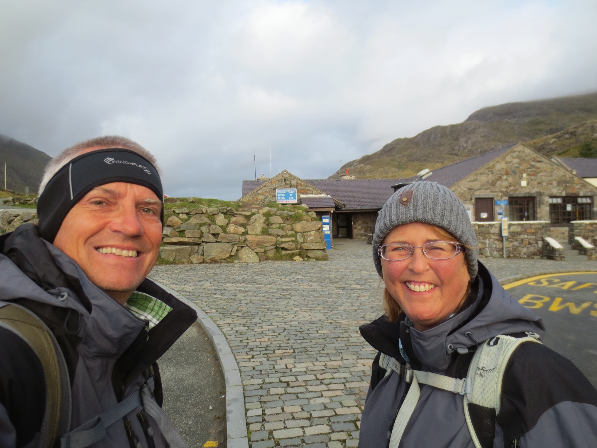
We paid £10 (yikes!) to park the car at Pen Y Pass, having arrived at 8am as the reports warned that it was a small and popular car park and gets full early. No problem for us, we were about 5th vehicle in.
We first spent a bit of time reading maps, changing to boots and prepping with the necessary layers for a mountain hike - then we were off. Of course a loo visit was also a must and we wondered about the standards of hikers here with "please respect" signs like this in the loos. Stealing toilet paper? Chucking garbage down the loo? With special mention to the bad reputation of the "3 peakers". Very uncool that this is necessary.

We took the red path - which meets a few other trails near the summit of Mount Snowdon. Hans later continued on the green path.

Outside the Pen Y Pass ranger station and ready to go.
The start of the Miners Track (which miners never actually used...). Don't let that stand in the way for a good name...

The Miner's Track is scenic the whole way - even with Hans in the photo. Not sure whether the ray of sunlight shining down on him at this moment was "a sign"? Sinner or saint?

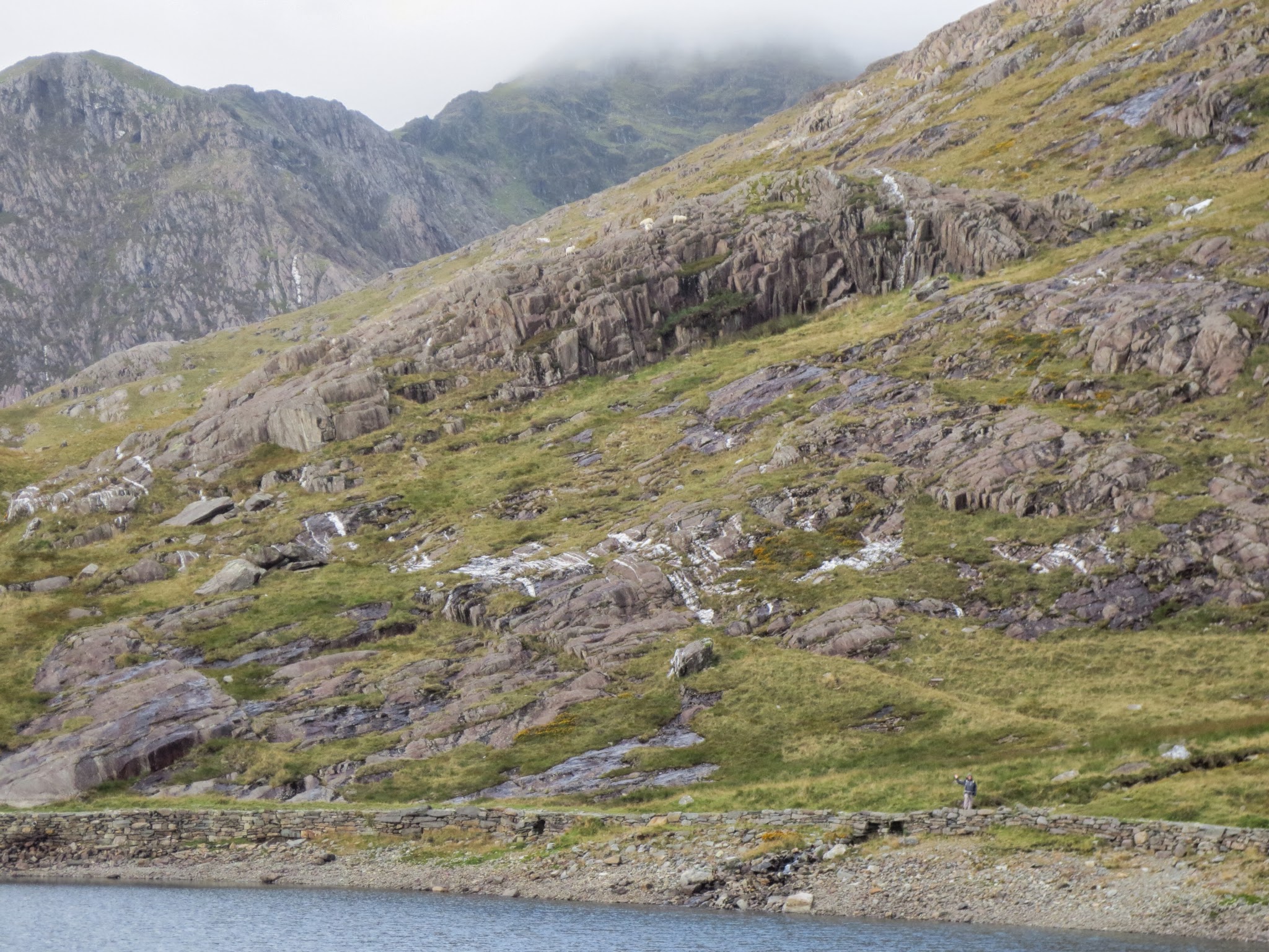
Looking ahead to Mount Snowdon in the clouds. The sheep graze on the hills around this track as we pass through a large farming estate.

This sheep had given up on grazing already and was taking in the view while perched on a rocky edge.

On the way to the summit we passed 3 tarns, this being the first little one we thought we should at least test the water. Yep - fresh - less than 10 degrees would be our guess. Hans still has his fingers. No frostbite.

At the second tarn, Di wandered ahead a bit while Hans was being photographer. Can you pick Di waving in this picture?
Mount Snowdon in shade in the background but for now the weather was perfect - perhaps 8 degrees and not much wind. This spot appeared to be protected as little yellow wild flowers were growing everywhere near the stream.

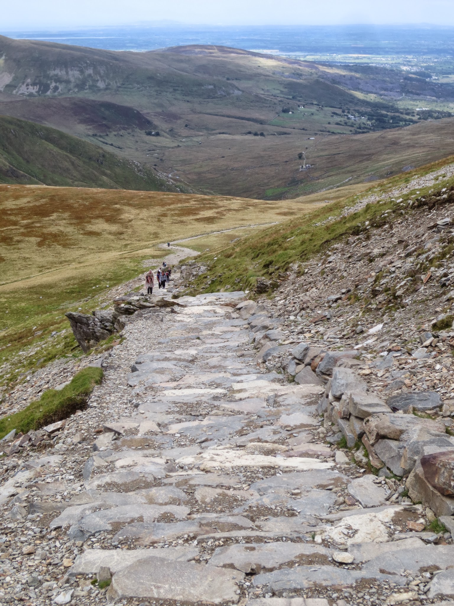
The Miners Track surface is excellent. It varies a bit from hard bedded gravel to major stones (like a roman road) to a very rocky surface near the top. The views are stunning and at 9am we were on our own...

...until here we bumped into a group of about 6 hikers in their 60's coming back down. When we asked them where they had been they said "the summit"...? They set off up the "yellow" track from Pen Y Pass, in the dark, at 3am to see the Harvest Full Moon unimpeded - but of course the summit of Snowdon is usually cloudy so they saw nothing. They seemed to still be in good spirits about their adventure and we were impressed.
We did not take a photo of them but here's Di enjoying the hike and the views.

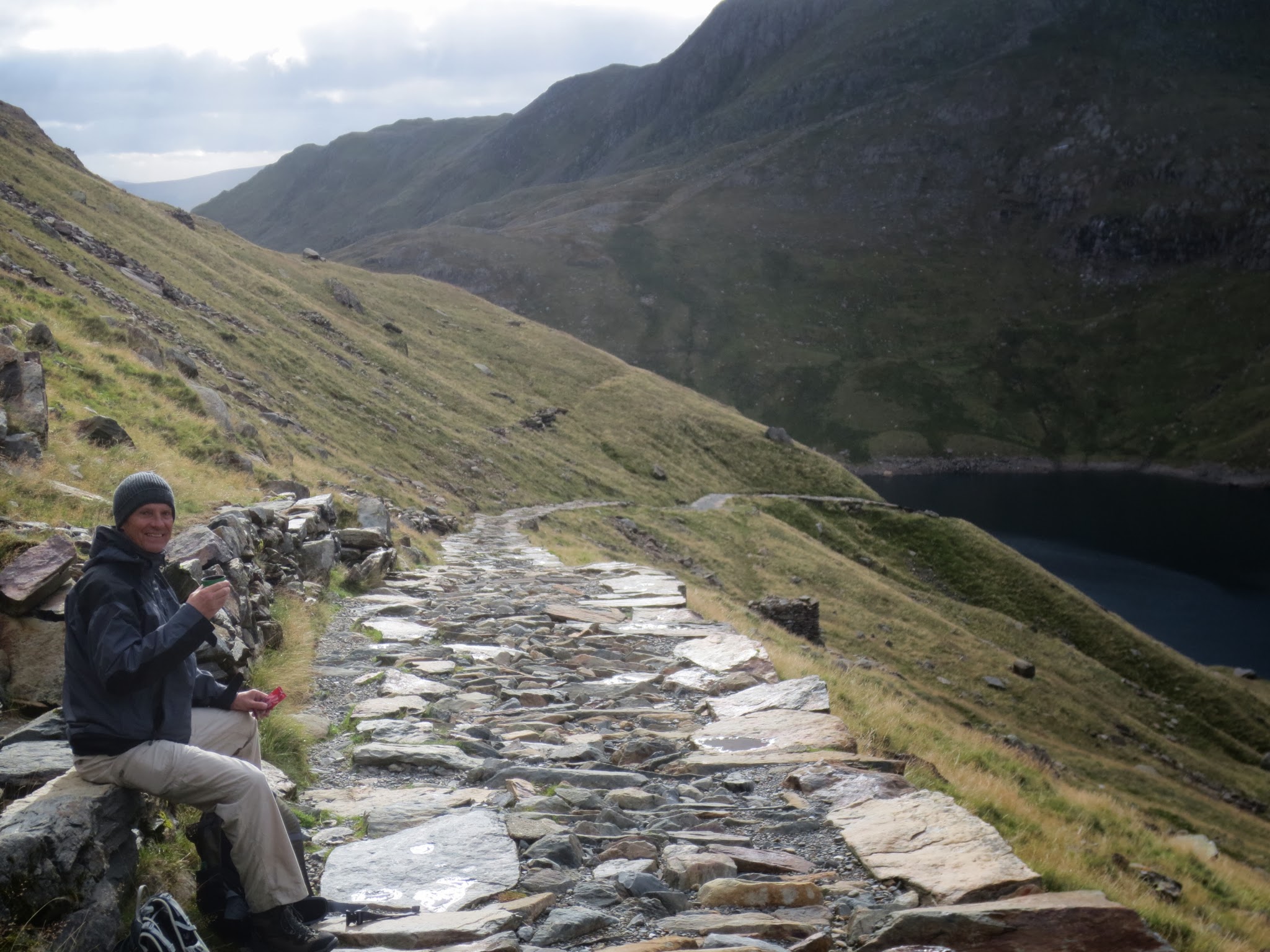
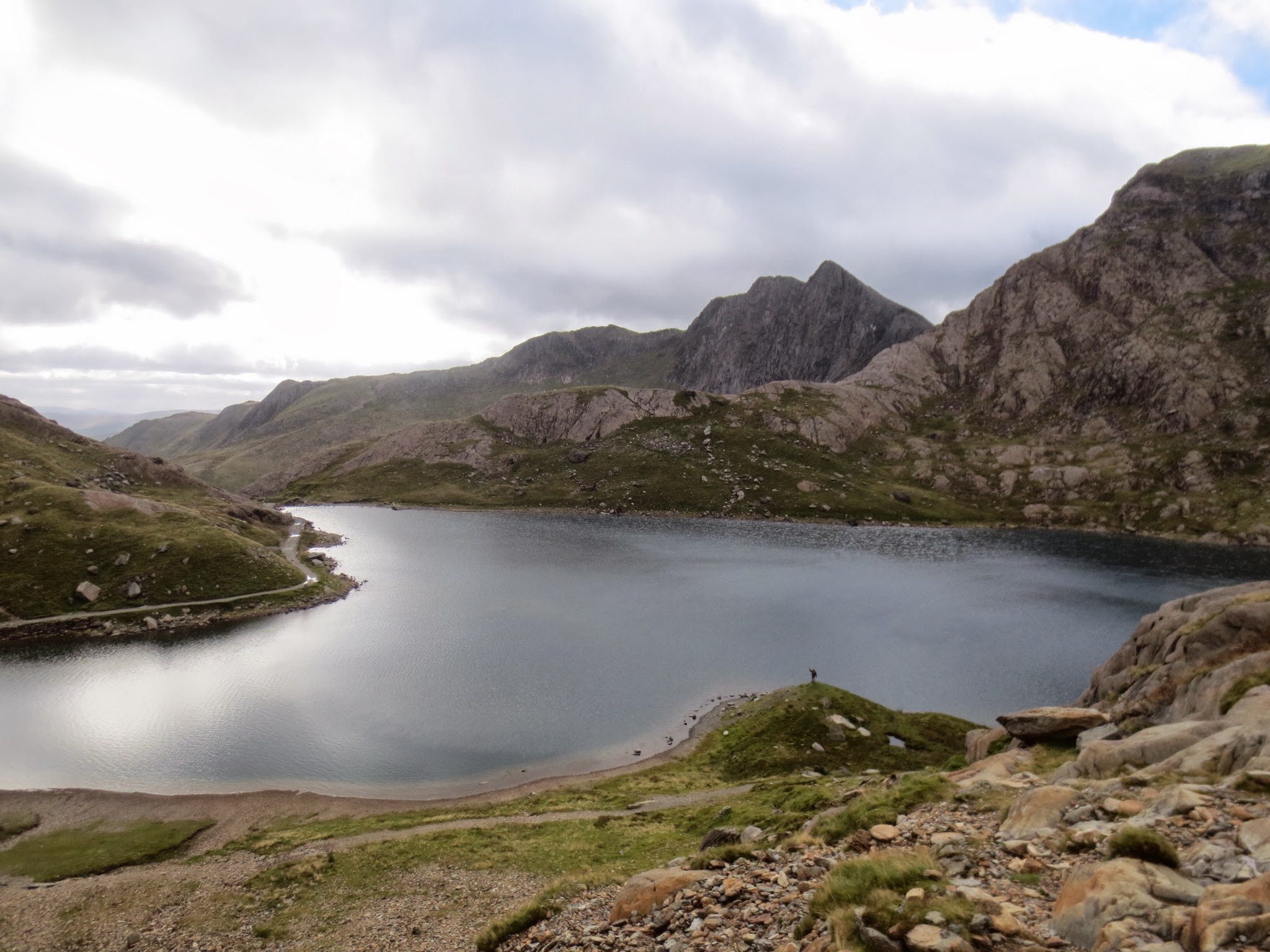
We took a break with tea from our thermos and some fruit at about 10am past the top of the second Tarn, called Llyn Llydaw. We found a sheltered spot from the wind which was noticeable and cooler as we ascended. Again, on our own.
The third and last Tarn is just little and sits, we guess, at about 250 to 300 metres higher than the car park and about 5km into the walk. Snowdon is the pointy mountain top behind Di - a further 450 - 500 metres to climb in just under 2 kms.
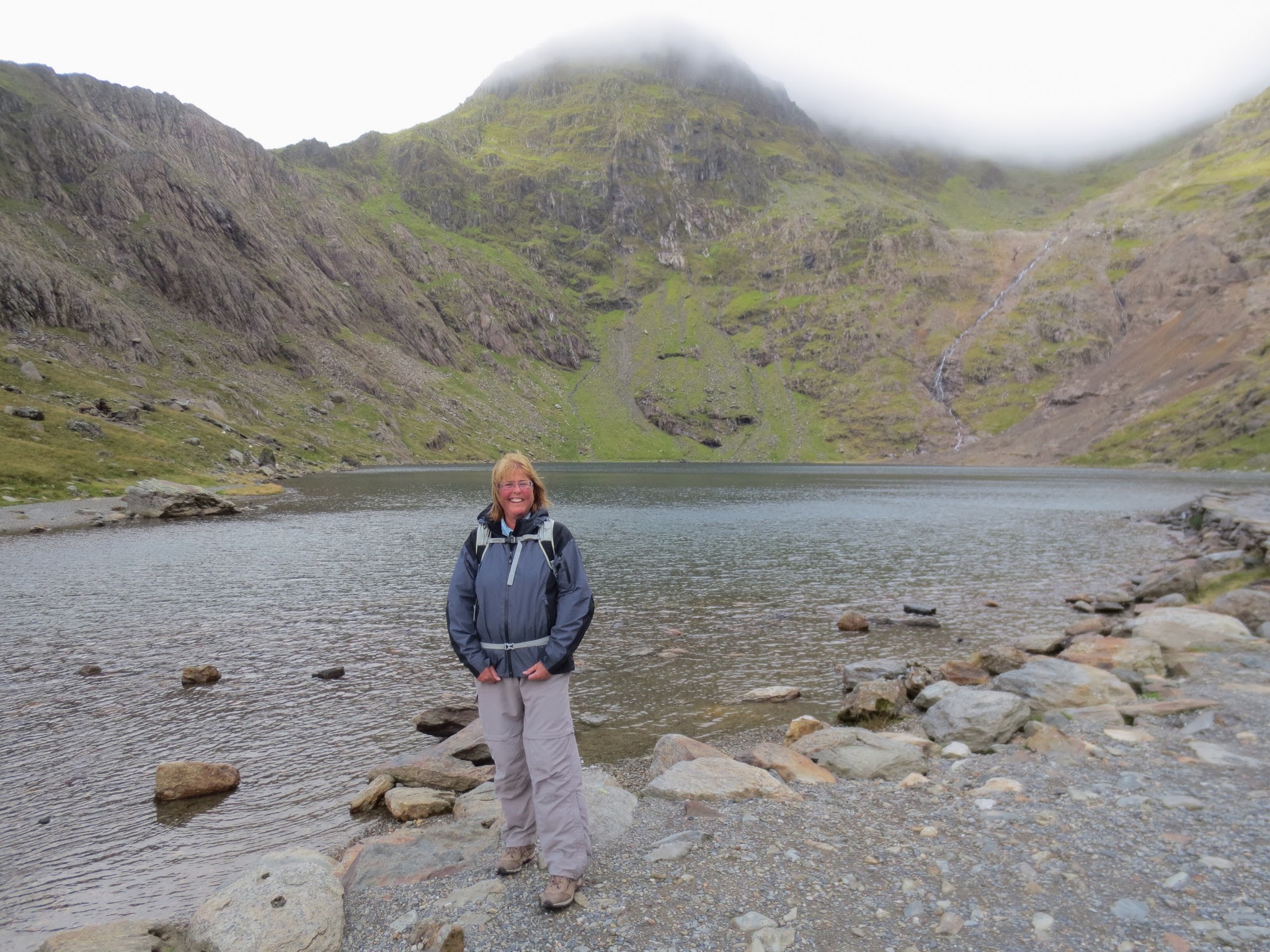
In other words, from here is gets "f...king steep" (Di's words). That's at least a 1 metre climb per 4 metre distance. The path becomes stairs and zig zags up the face of the very steep valley terminus.
Hans was ready to go. Di's knees were shaking with the thought of steep, rocky paths traversing what to her look like cliffs - nup not "Di friendly" and here we parted company. No regrets for Di - the hike to here was beautiful too. We made plans to meet at the train station at Llamberis (more on this later) at 2pm.

Di masters her own little summit, waves goodbye and headed back to the car (5km back down the mountains meaning that she did slightly more than 10km today).
We could still see each other for quite som distance as Hans gained a lot of height quickly on the zig zagging track. Di was keeping track of Hans for a few more minutes.
Di's walk back was uneventful, about 75 minutes return and still very scenic, with the difference that on the way down she passed about 20 groups walking up. She only stopped to chat to 2 groups - one older lady who asked about the weather higher up, and 2 young blonde girls who had an ordinance survey map but still asked Di whether this was the Miners Track and where was Snowdon. Hmm...

Back at the car Di found the car park full, roped off and with 2 cars waiting to get in at 11.30am. One thing Di struggles to get used to is that an early start on a hike here seems to be 10am. Plenty of people start their hikes a lot later too.
In the mean time, Hans started the climb uphill (which of course was no problem after Ben Nevis).
At this point it was approaching 11am and more people were on the track - mostly following Hans but some on their way down. The views continued to be spectacular.

...Until you reach the cloud level where you can still see some views, sort of...
From here on Hans got the combined challenge of reduced visibility and a rocky steep path. No drama, just get on with it.

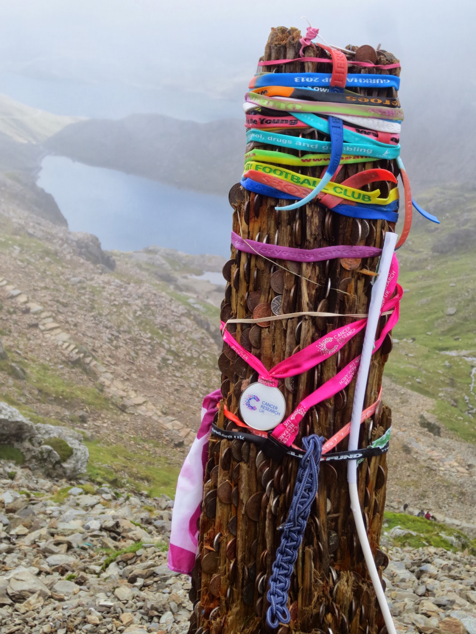
Suddenly, this on the trail... Different kinds of rubber wrist bands and coins stuck into it a pole of sorts. Something was going on here that Hans didn't know about.
As reported by the Walking Englishman, and shown on maps, the path traverses quite a steep valley edge. (Di looked at this photo afterwards and said "no way" - it is not the height that scares her, just the possibility of falling...). Hans note... The picture is purposely exaggerated as Hans angled the camera to make it look worse than it was...

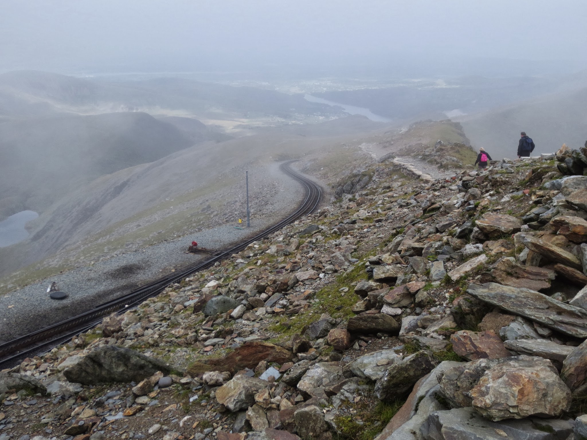
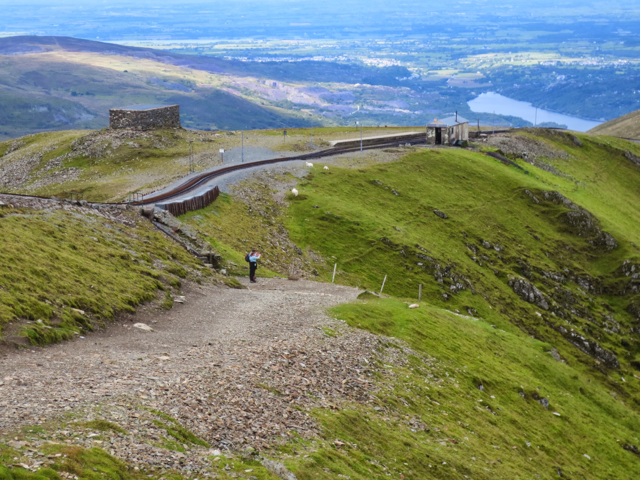
And then suddenly, Hans was out on the "flats" again. This is the view to the right and downhill with the trail and to the left the train tracks down to Llamberis. Yes, there is a small open train going all the way from Llamberis to the Mount Snowdon summit. Hmm... Cheating!

Towards the left, there is just a little bit further to go until you reach the summit. Off he goes, Hans...
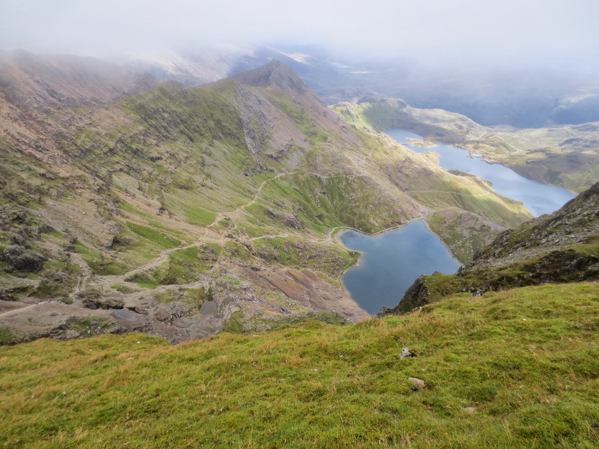
Spectacular views from up there. Here we are looking down on the lakes we passed earlier.

Looking for a ghost train, but Hans couldn't see or hear anything. Too misty perhaps...

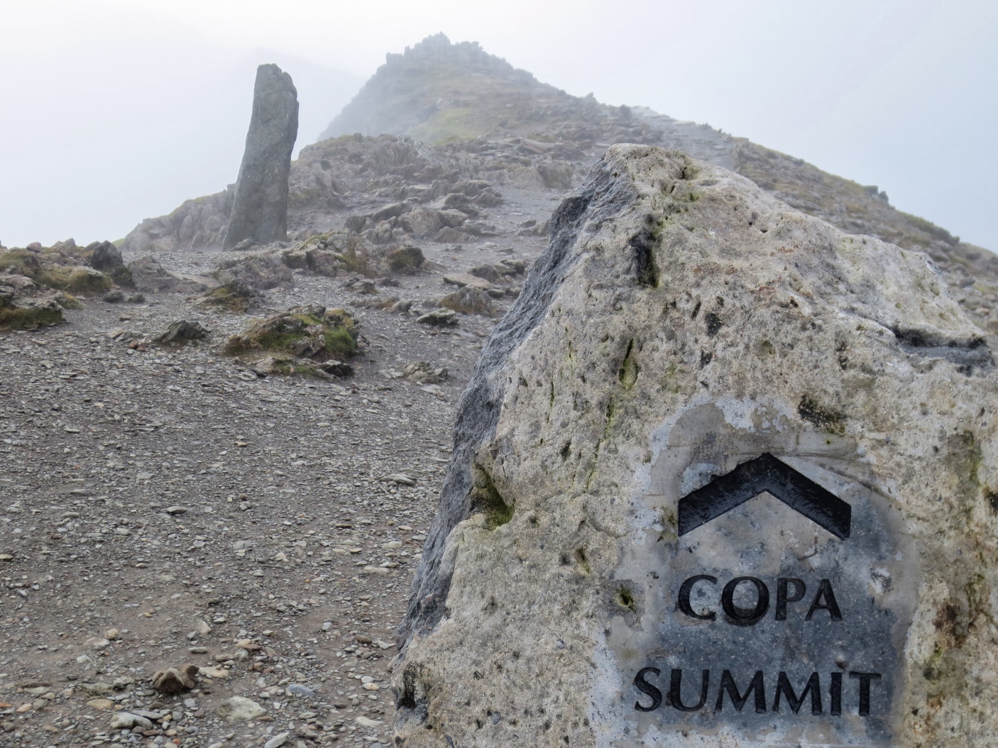
Up there somewhere is the summit of Mount Snowdon. Lets check it out!

Almost there... Only a few more steps...

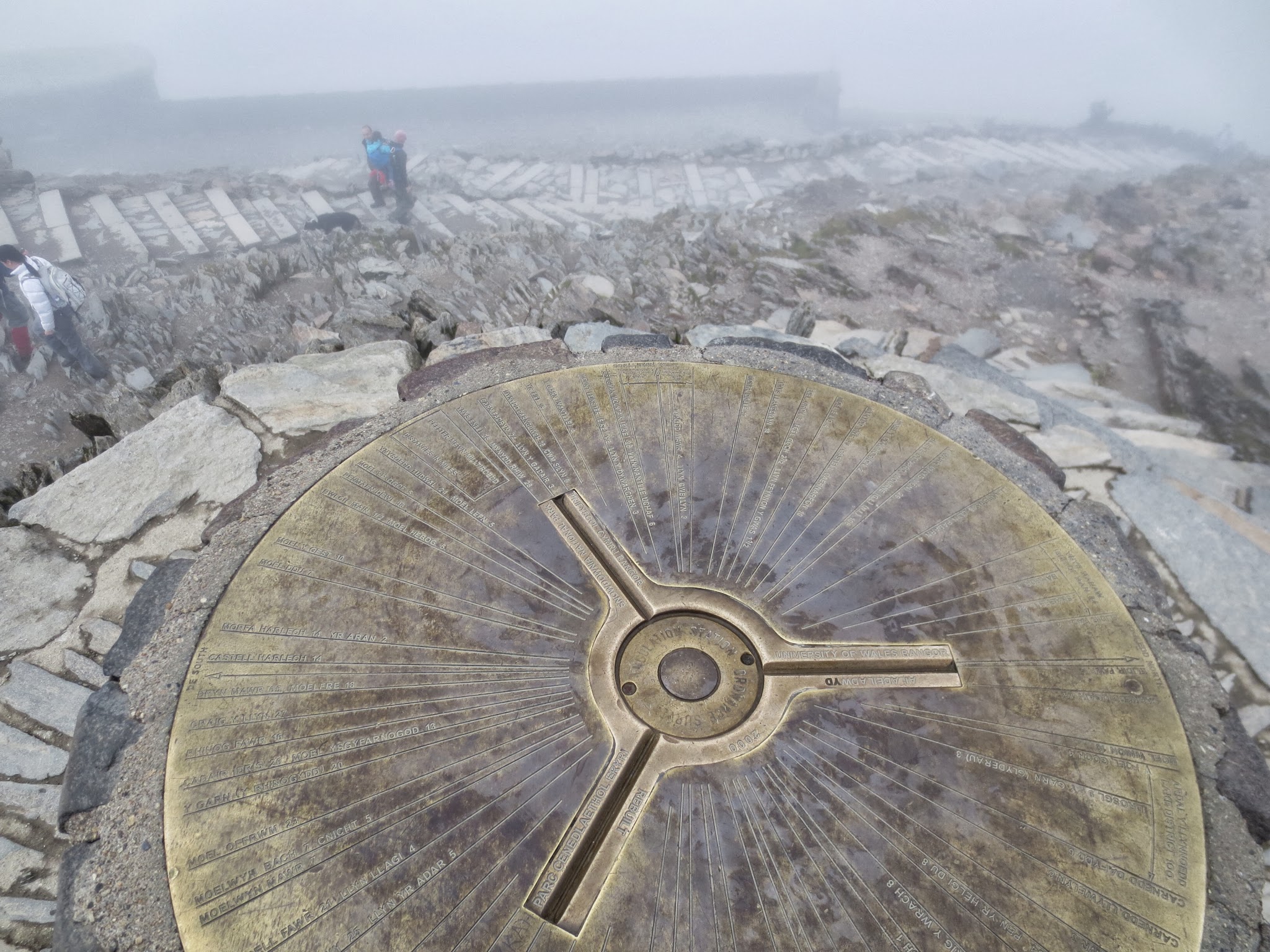
Made it! Hans at the summit of Mount Snowdon.
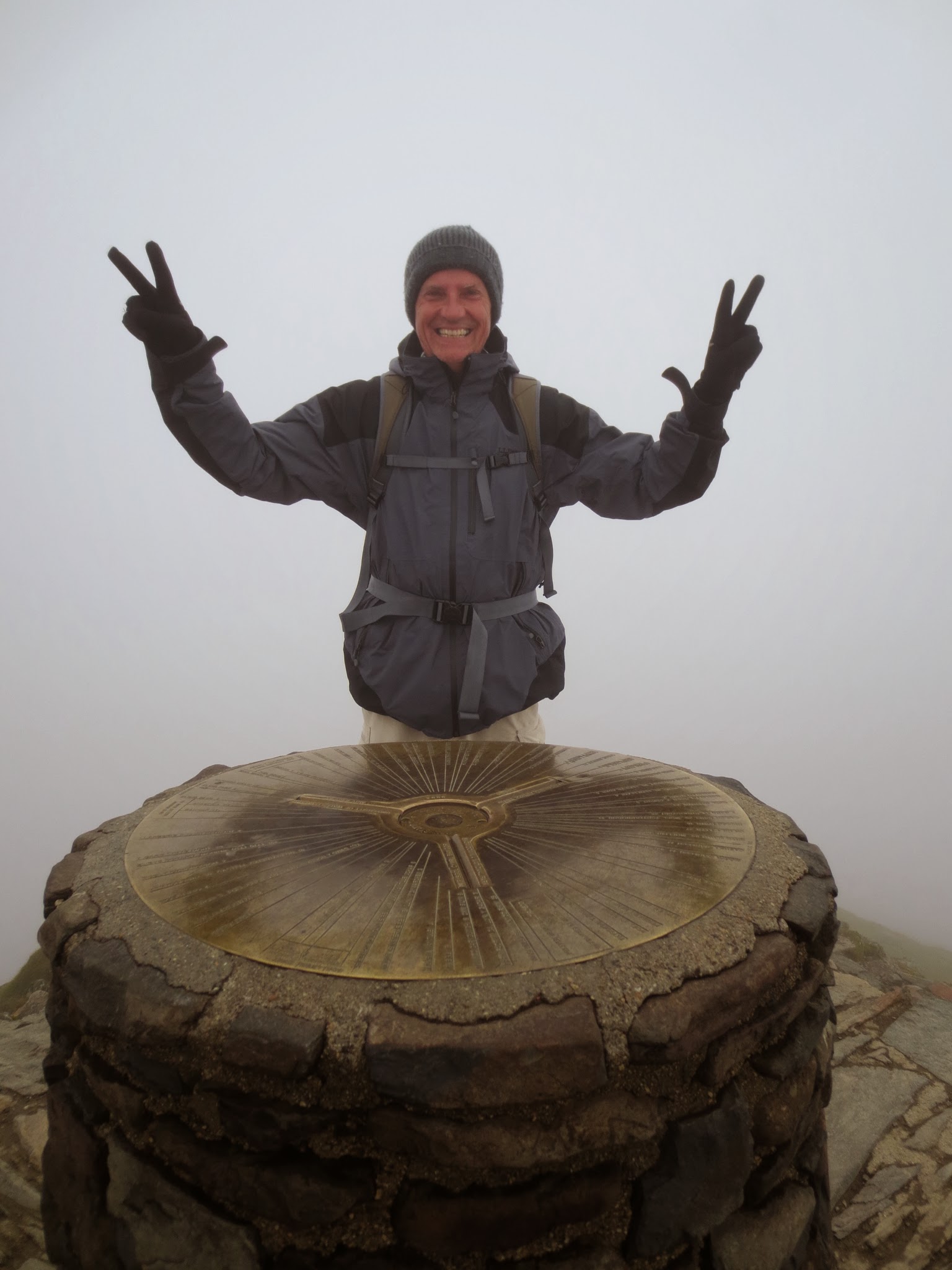
As when Hans hiked up to the summit of Ben Nevis a couple of weeks ago, views were again non-existent at the summit of Mount Snowdon. Hans could barely see the building housing the end station for the train with its cafeteria and facilities.
Then the clouds lifted somewhat and there it was among the rocks and stones...

Hans wandered down and engraved on the side of the building were some info and stats. Mount Snowdon is not exactly a tall mountain reaching only 1085 meters, but it is high enough to have its own microclimate.

Hans went inside and had a well deserved coffee break (what a luxury mid-hike) and some chocolate of course. Very alpine!
Note the lady in pink behind Hans. Hans had hiked past her earlier on the way up and when he bought his coffee in the cafeteria, she was before Hans in the queue and bought only a... Bottle of water!? Water, isn't that something that every hiker bring with them in enough supply while hiking...?

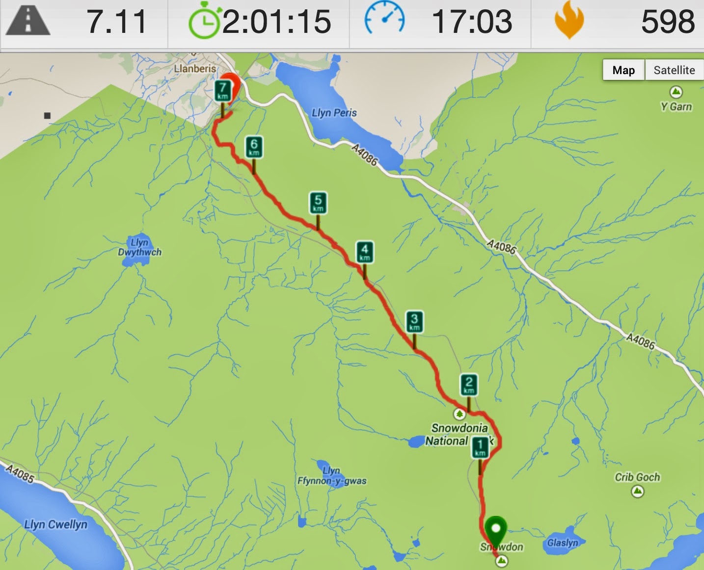
As Hans left, sort of disaster struck. Hans, as the reader may have noticed, uses the Runkeeper app on his iPhone to get stats for the hike. It had worked as normal all the way up to the summit, but Hans forgot to pause it while inside and when he checked it outside, the GPS coordinates were all over ths shop. Hans had apparently hiked something like 43km and been all around. Not much other to do than to cancel the tracking and restart Runkeeper again.
The true stats to the top had been 7km over 3 hours from the beginning of the Miners Track to the summit (Hans checked earlier). Hans then hiked from the Mount Snowden summit down to Llamberis as per below, making the full hike a total of 14.1 km over 5 hours.
Also, if you look closely on the map below, you can see a faint grey line running parallel with the red hiking line. That's the traintrack.
Yes, Hans was very lucky with the weather. It partly clearly up and he got views coming and going as he commenced his descent.
Again, looking back to from where Hans came from.
The next two pictures are taken from the same spot. They show the descending trail with the train tracks in parallel.

Up close, one of a handful train stations can be seen.

Here we are closer to that tunnel that you saw in the previous picture, up on a ridge. The trail went through the tunnel and onto the other side (later it went back to this side again).
Looking back from where Hans descended from Mount Snowdon.

Most of the trail was rocky with loose stones and gravel and sometimes with big stones laid like this.
Here was a section that would probably would get stones laid as per above. Of course, it was Friday around 1pm when Hans passed and not one single worker could be seen. Gone somewhere else for lunch, perhaps? Pub?
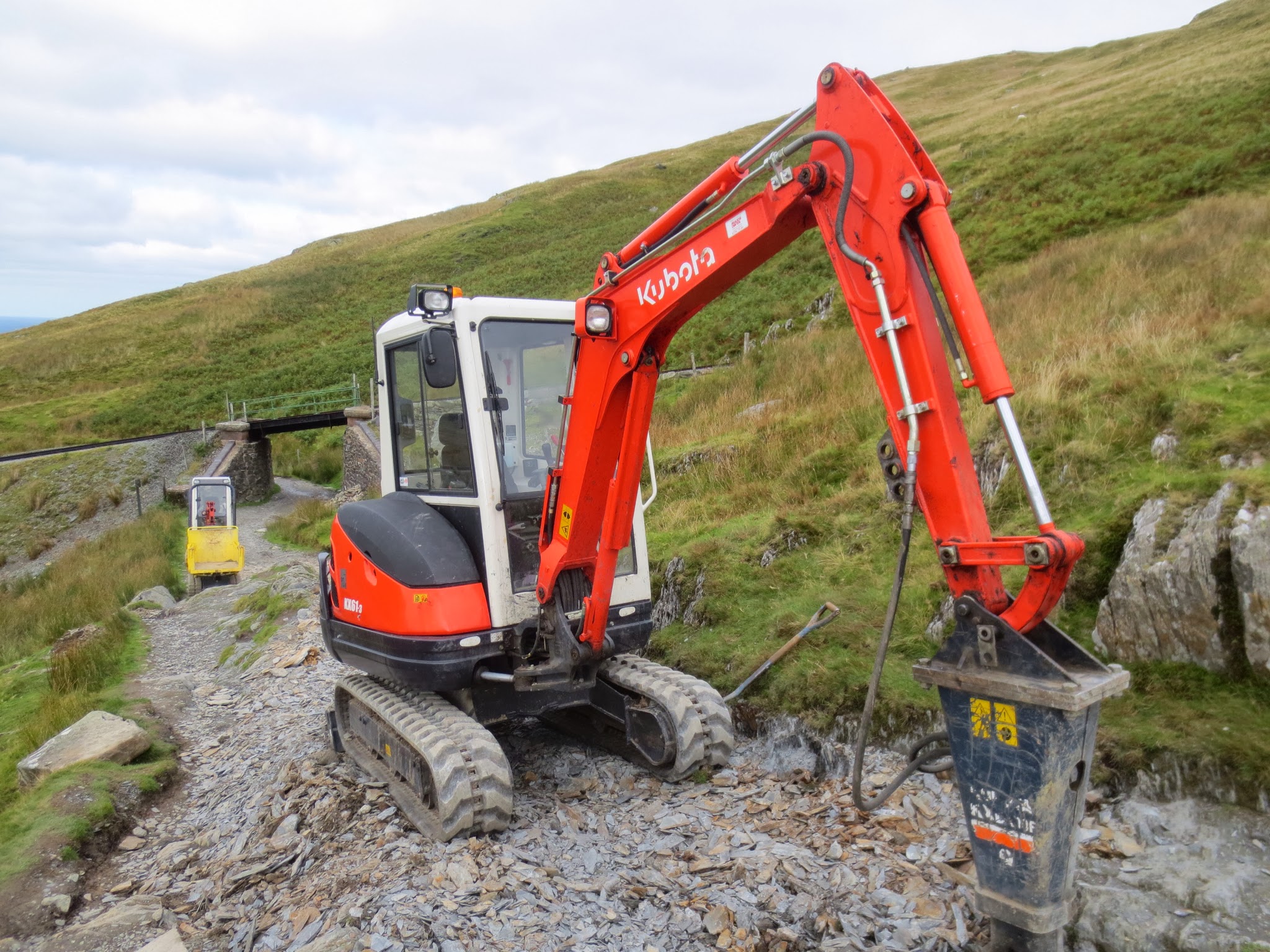
Newly laid stones...

As Hans arrived at the summit around 11.15pm, he was not really hungry, but on the way down around 1pm, he decided to stop here for lunch, overlooking yet another train station but with several trains and workers this time.

Almost at Llamberis, black arrows with orange background started to appear. Later, we saw that there is a triathlon coming up in the hood. Hans was not sure where they would be running as these signs were not at the top, but perhaps once you are on the trail, you will find yourself easily on the way up.

Di meanwhile had driven down to Llamberis, and took her book and lunch to the lakeside and enjoyed about 90 minutes of reading and relaxing. Lovely.
At 1.45 she set off to find the Llamberis Mountain Train Station, where she was due to meet Hans at 2pm. Paid parking - nope - so she drove down some streets which mentioned "Mount Snowdon Footpaths". Yep, just as she was driving by Hans pops out from the end of a footpath at 1.55pm. All perfectly planned (ha ha - just lucky or course!)
The drive home was easy going and we decided on a short detour to our nearby town of Llandudno, which we know has an Aldi. Found it! Bought some more stuff for £10 - perfect.
A relaxing evening with bath to soak some muscles, more Chinese takeaway food, and TV. Very happy with our lot. Good night.
No comments:
Post a Comment